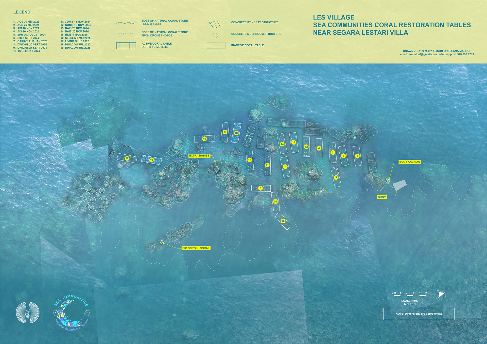
Current spatial records of the Sea Communities coral restoration project are diagrammatic layouts of the coral tables. Other areas have been mapped to a higher degree of precision with very specialized, labor intensive procedures. This map of the area in front of the Segara Lestari Homestay was produced to a utilitarian level of accuracy using the relatively simple and inexpensive workflow described below.